The IGI property model
Overview
IGI's geochemical software (Metis and p:IGI+) contains a comprehensive industry-relevant property model. This page outlines key points and concepts of the IGI property model. This information relates to V3.0 of the software.
Usage: Throughout the system, particularly during import and interaction with the range of visualisation artefacts.
Introduction
IGI's property model was created as a comprehensive and meaningful set of parameters, arranged in an appropriate schema, that enables users to store data and associated metadata for efficient interpretation.
Contributions to the property model
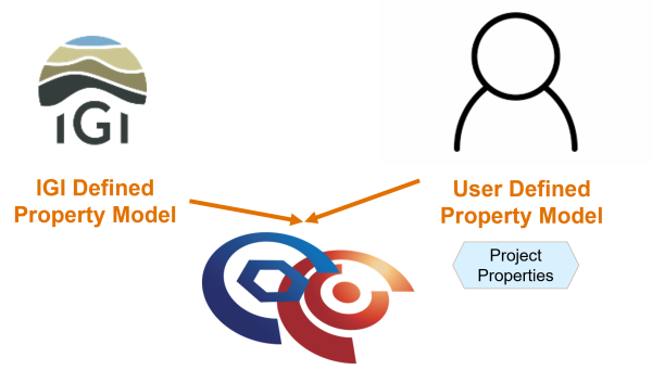
The property model used across IGI’s software (Metis [database] & p:IGI+) is comprised of 2 parts:
- Properties IGI has defined and shipped with the software.
- Properties created by users and which are project-specific.
- These properties are known as project properties and cannot be sent to or stored in any Metis database.
Conceptual Geochemical Property Model
The IGI property model centres around a collected sample.
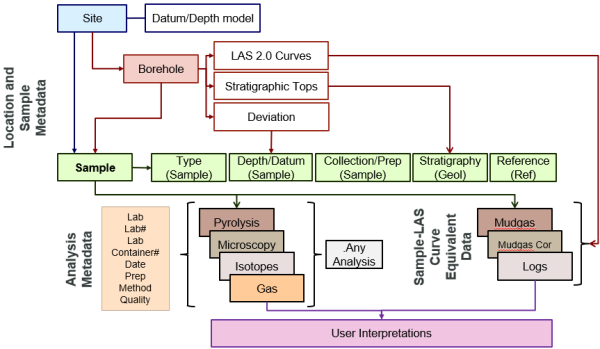
Several key domain concepts exist in the IGI property model:
- Sites
Information related to where the sample came from. This domain contains information such as site location information (geographic/geologic) and datums.
- Boreholes
Information related to boreholes drilled at a given site. A site can have multiple boreholes linked to it. This domain contains information such as identification and drilling information. Boreholes can have additional reference data, such as stratigraphic tops, deviation paths, and LAS curves, which can provide context and labels to associated samples.
- Samples
Represent the concept of a quantity of material (solid, liquid or gas), which is analysed to measure one or more properties. A sample can be directly associated with a site or a site's borehole. ****
- Analyses
Empirical methods (often laboratory-conducted, but also including depth-equivalent wireline and mudgas logging) used to generate data. A sample will typically be subjected to one or more analyses, each measuring a range of properties. The type of analysis applied to a sample depends on the sample material, the analytical plan, and the available budget and equipment.
The software supports an extensive set of analyses.
- Interpretations
Conclusions/labels/classifications given to samples after reviewing and integrating the data. Interpretations can be semi-automated using Rulset artefacts.
Understanding the IGI property model
To effectively use the IGI property model in p:IGI+ and Metis, it is necessary to understand some of the details of the model.
- Property Groups
- Property Naming Elements
- The "Any" property concept: This explains how we have provided a system to simplify the detailed property model during interpretation.
Video tutorials
None Available
Return to the main User Guide page
© 2026 Integrated Geochemical Interpretation Ltd. All rights reserved.